On the Trail
This 7-mile section of the paved Historic Columbia River Highway State Trail has it all: side hikes, waterfalls, nonstop views, a visit to Bonneville Dam, and great places to watch spawning salmon (in season). The turnaround (or halfway) point is Cascade Locks, where you can find brewpubs, ride across the Bridge of the Gods, buy fish caught by Native Americans, and grab some snacks for the ride back.
The round trip is 14 miles, with the trail gaining and losing 100 feet of elevation several times for a total gain and loss of about 500 feet. Near Eagle Creek, two levels of the State Trail are stitched together by a staircase. Roll your bike up a gutter or carry it. Bring a bike lock if you want to hike along the way or eat in Cascade Locks, and money if you want to pay the toll to cross the Bridge of the Gods. There is one snack stop and restroom break along the way, at Bonneville Lock and Dam.
Permits & Pets
The Historic Columbia River Highway State Trail is managed by Oregon State Parks. No passes are required. Dogs must be on a leash no longer than 6 feet.
Trail Notes
- From the John B. Yeon trailhead, walk or ride east on the State Trail. There are no restrooms at the trailhead. The closest restrooms are at Ainsworth Day Use area.
- Please always stay on the trail and clean your boots before and after you hike. Hikers and their dogs are common vectors for spreading invasive seeds
Points to stop at, in the order encountered, are:
McCord Creek Bridge
The original 365-foot McCord Creek Bridge was built in 1915 and was more utilitarian in design, lacking the beautiful arches and design elements of other Historic Columbia River Highway bridges that Samuel Lancaster and Karl Billner designed. This bridge has been replaced a couple of times, and the one standing today over McCord Creek was built in 2012 with a vintage Art Deco design. After the ride, you can explore McCord Creek’s waterfalls with the Elowah Falls and Upper McCord Creek Falls hikes.
Moffett Creek Bridge
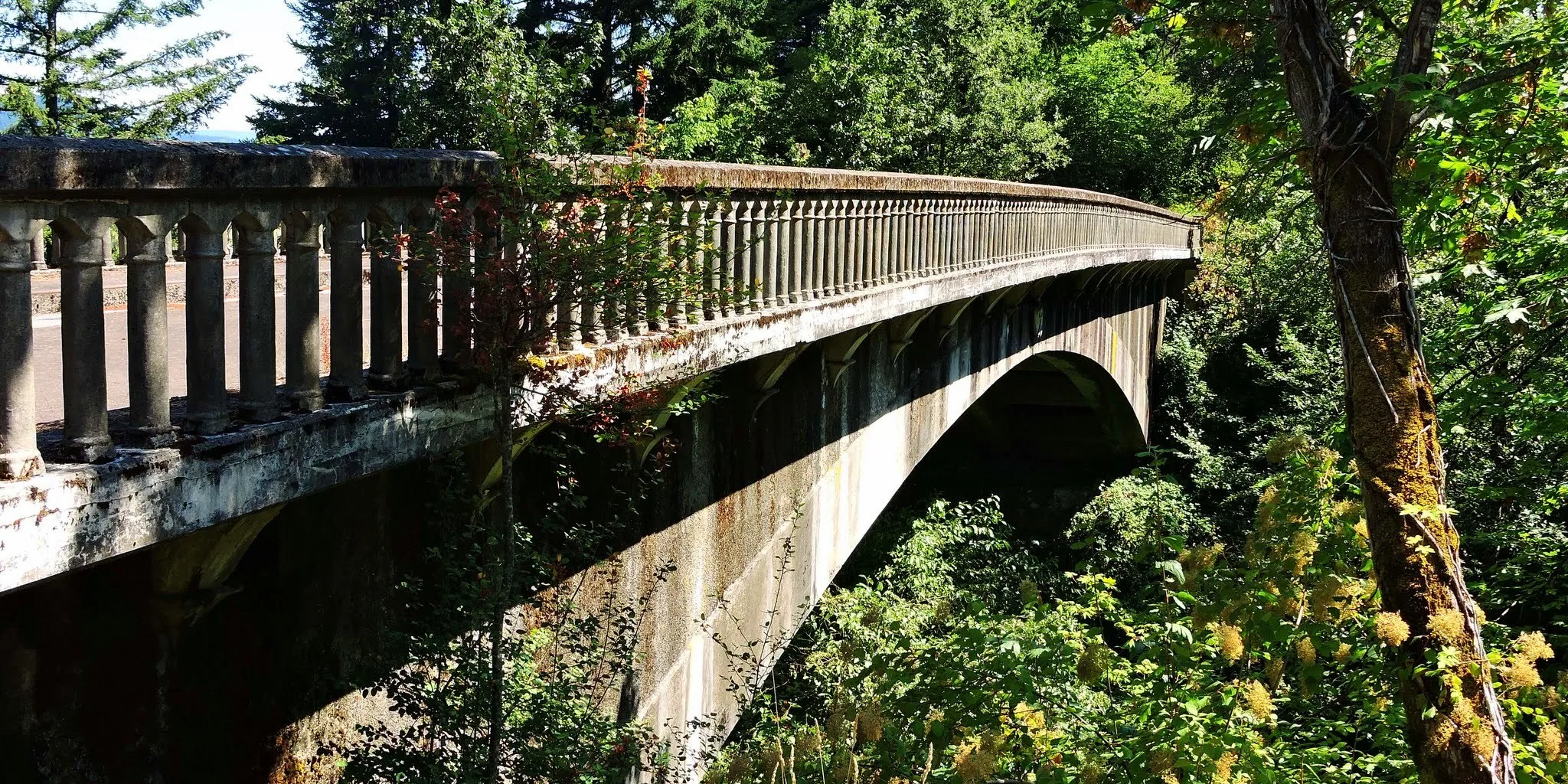
Built in 1915, and abandoned in 1950 when the newer highway bridge was built, this bridge was rescued from the blackberries in 2000 when it became part of the State Trail. It’s 205 feet long, with an arched, 170-foot span; the arch, barely visible to the casual observer, rises 1 foot for every 10 feet in length. The bridge is designed to pivot with expansion and contraction on three massive cast iron hinges, one at each abutment and one in the center. At the time of its construction in 1915, Moffett Creek Bridge was the longest three-hinged concrete flat arch bridge in the U.S.
Wahclella Falls and Bonneville Lock and Dam
The 0.9-mile, one-way walk to beautiful Wahclella makes for a nice break. Afterward, pedal under I-84 to visit Herman the Sturgeon. He and rainbow trout swim in rocky pools at Bonneville Lock and Dam, a National Historic Landmark. The fish-rearing ponds are part of the dam’s beautifully landscaped grounds. Restrooms are here, along with snacks and coffee in the gift shop.
Tooth Rock Tunnel
The State Trail here was built in 1996; the original Columbia River Highway in this section was destroyed in 1937 when it was realigned and the Tooth Rock Tunnel built. The tunnel is still in use, for eastbound lanes of I-84. The State Trail passes above it. Views are superb. Watch for the stop sign on the trail. Beyond it the trail abruptly stops at a staircase.
Eagle Creek Park Stairway
This stairway dates from 1996 and replaces a section of the old highway destroyed in 1937 during construction of the Tooth Rock Tunnel.
Eagle Creek
- Next up is famous Eagle Creek, one of the earliest developed Gorge recreation areas. In 1915, the new Columbia River Highway had become so popular for auto touring that the U.S. Forest Service created its first-ever public campground here.
- Next to the State Trail is the Cascade Hatchery. It was built in the late 1950s on the site of a roadhouse lodge and cabins that operated from 1915 to 1937. Take a self-guided tour, 7:30 a.m. to 4 p.m., of the coho salmon ponds. Each year, millions of fingerlings raised for the Umatilla, Nez Perce, and Yakama tribes leave here by tanker truck to be released in other creeks. Other fingerlings are trucked to the Oxbow hatchery in Cascade Locks to be released into Herman Creek. A display on the east side of the building has good information on salmon.
- In fall Eagle Creek is an excellent place to watch chinook salmon. After living in the Pacific Ocean, the fish return to spawn and die in the stream they were born in. Watch them spawn from a charming fish-viewing observatory built in 1915 for the old highway, or from vantage points along the creek-side road. Viewing is best where the water riffles over rocks. The female swishes her tail above the gravel to create a redd, or nest site. With the male beside her, she releases eggs and he releases milt (sperm). The fertilized eggs attach to gravel in the redd, and the female swims upstream and fans her tail to cover the eggs with more gravel. She protects the redd for a few days; the male leaves to find other females. Both soon die. Their bodies become food for eagles and scavengers.
- The Eagle Creek Bridge is one of the few bridges on the Historic Highway with a stone veneer over its reinforced concrete.
- Bike upstream on the road along Eagle Creek to the Eagle Creek trailhead. If you fancy a hike, lock your bike to something sturdy. To the left as you ride up to the trailhead are old campsites with stone grills scattered on the hillside, and a large old group camp building, work of the Civilian Conservation Corps in the 1930s. The current campground is a half-mile ride uphill.
- Don’t miss this last Eagle Creek nugget: Bike downstream on the road signed “dead end.” Ride under I-84, along the creek, to the gate for the Eagle Creek Overlook. It’s a group campground, so if the gate’s open, stay away to give campers their privacy. If the gate’s shut, proceed on: That means no one is using the group campsite. Rangers gate the road because they don’t want hikers parking here for the Eagle Creek Trail. Ride the road to the top or take a foot trail that begins near the mouth of Eagle Creek. Up on the bluff, the Northwest-style shelter and stonework were built by the CCC in the 1930s as an observation overlook of Bonneville Dam, then under construction.
- East of the shelter, a trail downhill toward the river leads to an overlook with views of Native American fishing scaffolds and the slide scarps of Table Mountain, Red Bluffs, and Greenleaf Peak. Land that slid off those peaks around 1700 formed the Bonneville Landslide that blocked the Columbia and created the Cascades of the Columbia. You might also see the Sternwheeler churn by close to shore here.
Ruckel Creek Bridge and Falls
The bridge over Ruckel Creek is from the original highway. It dates from 1915. After it was abandoned in 1937, when the highway was rebuilt in this area, its arches partially collapsed. In 1999, the bridge was restored and brought back into use as part of the State Trail. The 46-foot falls downstream of the bridge is easy to see but easy to miss, too. Look over the short but stout bridge railing.
Bridge of the Gods and Cascade Locks Trailhead
- The eastern end of this State Trail segment is under the Bridge of the Gods. The bridge was built in 1926 at the spot where the Columbia squeezes itself through a narrow channel. Part of the Pacific Crest National Scenic Trail, the bridge takes the Native American name for the natural land bridge that dammed the river here after a great landslide roared down from Table Mountain on the Washington shore. A walk or bike ride across the bridge offers big thrills and views.
- Beyond the bridge, ride into Cascade Locks for a meal. From WaNaPa Street, the main commercial corridor, turn left on Portage Road to ride down to the waterfront and Cascade Locks Marine Park, site of the old U.S. Army Corps of Engineers operations of the Cascade Locks from 1896 to 1938, when Bonneville Lock and Dam began operations.
Other Hikes from This Trailhead
Friends of the Columbia Gorge does not track trail closures. If you are planning a hike in the Gorge, please check other sources in advance for the latest updates, including the U.S Forest Service, Ready Set GOrge, and AllTrails. Recreational activities in the Gorge can involve risk of injury, death, property damage, and other dangers. Friends does not assume responsibility for any such outcome resulting from the use of the information on our hiking web pages. Your use of these web pages is strictly at your own risk.
Directions & Travel Tips
Eastbound I-84: Take exit 35/Ainsworth. Turn left at the stop sign, then immediately right onto Frontage Road. Drive east on Frontage Road 2.1 miles and turn right into the John B. Yeon trailhead and parking area, just before the road re-enters eastbound I-84.
Westbound I-84: Take exit 37/Warrendale and head west on Warrendale Road 0.25 mile to a stop sign. Turn left, drive under the freeway, and turn left onto Frontage Road. Drive 0.25 mile east to the John B. Yeon trailhead and parking area. It is on the right side of the road, just before the road re-enters eastbound I-84.


